Highlights:
- We coordinated and worked with multiple Pueblos, other Governmental Agencies, and private land owners to get permission to survey and to complete the work in an accurate and timely manner.
- We safely completed brushing and surveying activities.
- Work was scheduled around migratory bird season.
Scope
The project was to survey and brush 111 existing rangelines for four sub-reaches along the Rio Grande passing through one pueblo and several counties. The following table is a summary of the work:
Prior to beginning field work, required written access permits from Sevilleta NWR, the City of Albuquerque Open Space Division, the MRGCD, and the Isleta Pueblo were acquired, and private owners were contacted as needed.
Description
a. A Safety Work Plan was written and a
review of all current Job Hazard Analysis (JHA) was completed. Any recent safety
issues were addressed in a revised General JHA or a specific problem with a new
JHA. The Safety work plan was given to the BOR at the kickoff safety meeting
where a schedule of field activities and priorities were established.
b. Our crews held tool-box safety meetings prior to fieldwork.
c. Office preparations began with importing the most recent endpoint file data,
supplemental control points, and any known published control points in the area
into data collectors. Overview maps were created for the field crews showing
the area for reference; detailed maps were also provided and showed the point
number, endpoint designation, elevation, and control monuments.
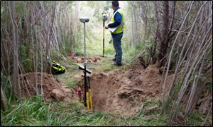
d. Field tasks include locating supplemental or published horizontal and
vertical control monuments to confirm validity. Once a minimum of two valid
control points was located, staking began to locate the endpoints per the Task
Order. Debris was cleared, the post repainted and straightened if necessary, we
re-labeled the post with the endpoint descriptor and replaced flagging; missing
posts were replaced. If an endpoint was missing or in a location that could be
washed out by river flows, a new point was set on line. All points were checked
for horizontal Third Order accuracy with a GPS Real Time Kinematic shot. This
stakeout routine was compared to the BOR provided data file. A distance based
Third Order standard of 1:10000’ was applied and if a point was valid, the
original point was held. If the point did not meet specifications or was
disturbed, we retied the point with an extended RTK session or in some cases a
rapid static session. A total station was used where there was heavy tree
canopy. The horizontal coordinates and closures were checked in the office by
the Senior Crew Supervisor for quality control.
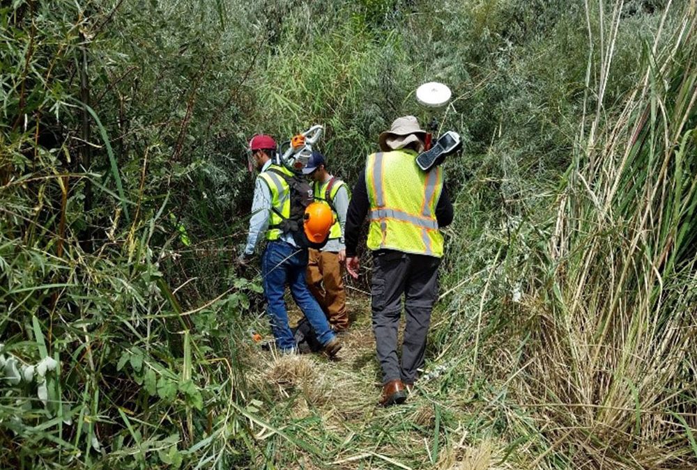
e. Rangeline Brushing: Prior to brushing, all related safety protocols were
reviewed with the field crews and sawyers were reminded they can never brush
alone. Once the endpoints were found and maintained or reset, line location for
brushing activities was marked. The sawyers cleared a three-foot-wide path
followed by the removal of brush by crew members. Hand tools were used to clear
the line in areas a chainsaw could not be safely used. As part of a quality
control check, the line was walked by the crew supervisor and inspected for
safety issues and the ability to see between points for levels. The toe of the
river was checked for brush issues that could prevent the data collection crew
from getting critical shots.
f. Differential Levels-Upon completion of endpoint data checks, differential
three-wire levels were run from endpoint to endpoint. Internal results were
checked for closure, if they were within 0.05’ of the BOR provided data and
current field elevations, the original point elevation was held. If necessary,
three-wire levels were from another line or a control monument. The new line had
a three-wire level ran from the closest control. The level books were reduced
in the field and checked again in the office by the Senior Crew supervisor for
completion and accuracy.
g. Deliverables included a Surveyor’s Report summarizing issues encountered, an
updated excel spreadsheet, electronic copies of the field notes, accuracy
verifications, weekly safety toolbox meeting sheets, permits, and private
property owner permissions.
We worked closely with the Hydrographic Contractor to provide endpoint data in a timely manner, as to not adversely impact their schedule. This work garnered our team a rating of “Exceptional” for Quality, Schedule, and Management on our CPARS evaluation.
We worked closely with the Hydrographic Contractor to provide endpoint data in a timely manner, as to not adversely impact their schedule.
This work garnered us Ratings of “Exceptional” for Quality, Schedule, and Management on our CPARS evaluation.